February 15, 2026 1:50 p.m.
A Winter Weather Advisory and a Winter Storm Warning will begin on Monday evening in central Douglas County.
Forecasters at the National Weather Service in Medford said a sharp cold front will pass through the region Monday night into Tuesday morning with a cold air mass to follow through at least Thursday. An Urgent Winter Message said snow levels will quickly lower from around 3,000 feet during the day on Monday to around 1,000 to 1,500 feet late Monday night into the early hours on Tuesday. Multiple waves of precipitation will move through the region while this cold air mass is in place, bringing multiple opportunities for low elevation snow. This will be a long duration event. After the initial front Monday night, precipitation will become more showery, resulting in periods of spotty and quick accumulations.
Forecasters said daytime heating will result in snow levels rising to around 2,000 to 2,500 feet during the daylight hours, then lower back down during the overnight periods. The best chances for accumulated snow down to the valley floors will be during the overnight and early morning hours.
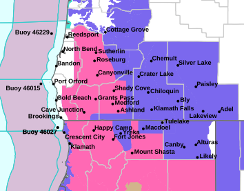
The Winter Weather Advisory is below 1,500 feet where a half inch to two inches of snow is expected except four to six inches in Camas Valley. The Advisory area includes the communities of Roseburg, Elkton, Sutherlin, Camas Valley and Canyonville as well as portions of Interstate 5, including Roberts Mountain pass on Interstate Five at 1,000 feet and highways 42 and 130.
The Winter Storm Warning is above 1,500 feet where heavy snow is expected. Total accumulations of six to ten inches, with twelve to eighteen inches expected above 2,500 feet. The Warning area includes the communities of Glendale and Tiller as well as portions of Interstate Five south of Canyonville and as well as Canyon Creek pass on Interstate Five around 2,000 feet.
The Winter Weather Advisory and the Winter Storm Warning will be in effect from 10:00 p.m. Monday through 10:00 a.m. Thursday.
Forecasters said travel may be very difficult to impossible. The hazardous conditions could impact the Tuesday morning and evening commutes. The heaviest snow is expected late Monday night into Tuesday morning.
Motorists should slow down and use caution while driving. Those who must travel should keep an extra flashlight, food and water in your vehicle in case of an emergency.
Listen to News Radio 93-9 FM and 1240 KQEN and check www.541radio.com to stay connected with updated weather information.