July 9, 2021 4:10 a.m.
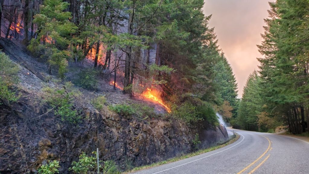
The Douglas County Sheriff’s Office continues to coordinate with fire managers, county commissioners, county departments and local agency partners regarding the Jack Fire burning on the Umpqua National Forest.
Sergeant Brad O’Dell said as of Thursday afternoon these evacuation levels are in place:
*Level 3 “GO!” – All residences and businesses between milepost 43 and 51 on Highway 138E. This includes all U.S. Forest Service campgrounds, the Dry Creek community, as well as residences on Illahee Road
*Level 2 “BE SET” – All residences and businesses between milepost 38 and 43 on Highway 138E. This includes Steamboat Inn and all residences on Brindle Bug Road and Steelhead Caddis Road. It also includes all residences and businesses between milepost 51 and 55 on Highway 138E including the Soda Springs Powerplant and surrounding areas
*Level 1 “BE READY” – All residences and businesses between milepost 55 and 60 on Highway 138E. This includes the Slide Creek area and the Toketee residential area along with Toketee Lake and surrounding residential sites
O’Dell said residents who have been evacuated as a result of the Jack Fire can call the American Red Cross at 888-680-1455 to be connected with resources.
A current and interactive evacuation map can be found at: https://www.dcso.com/evacuations
All residents of the county, especially those under official evacuation notices are encouraged to sign up for the Douglas County Emergency Notification System. This is used to notify the public regarding police activity, fires, evacuations, missing persons and other information. Landline telephones are already uploaded in the system but cell phones and email addresses can be added. Go to www.dcso.com/alerts.
Due to public safety concerns and to aid in fire suppression efforts, the Oregon State Marine Board has issued a temporary rule closing a portion of the North Umpqua River. The closure is from the Boulder Flat boat launch at river mile 60, downstream to the Alder Creek confluence at river mile 51.3.